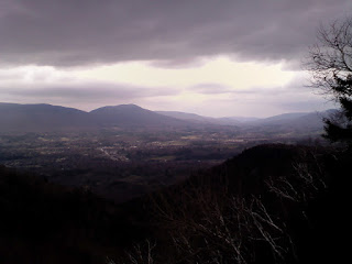
Vermont in April
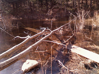
Beaver Dam
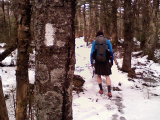
I think Red and I are the first Long Trail hikers out here this year. The volunteers won't even be out for a few weeks to get the trail ready for the season. We got a few snowflakes yesterday too. I don't expect to see many other hikers out here. Potentially being one of the first to complete the Long Trail this year will make up for being one of the last to finish the AT last year.
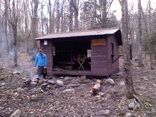
Red at Congdon Shelter
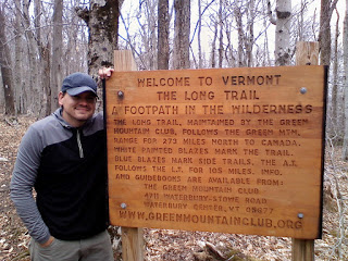
The Long Trail
Route 66 Day 18: The End of the Road
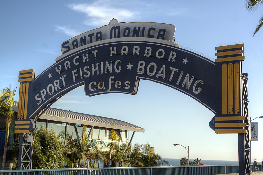
We reached the end of Route 66 at the Santa Monica Pier three weeks ago. We packed so much into this trip and I took way too many photos to keep it up-to-date. Getting to the end of Route 66, however, was only half our journey. The ride back home was just as memorable and filled with nine more national park visits.
I will post photos from those days when I'm back in civilization. I dropped Liv off back home in Kentucky and after spending a few days on the farm with her and Sixgun, I drove to New York City to pick up Red.
I will post photos from those days when I'm back in civilization. I dropped Liv off back home in Kentucky and after spending a few days on the farm with her and Sixgun, I drove to New York City to pick up Red.
 Red and I are now headed to the southern terminus of Vermont's Long Trail. It is a 273-mile trail that spans from the borders of Massachusetts and Canada. This will also cover the section of the AT in Vermont that was closed during Hurricane Irene. I'll post our progress and stories along the way.
To Liv, thanks for quitting your job and sharing yet another great adventure with me. I hope there are more to come.

A Backpacker's Life List by Ryan Grayson is licensed under a
Creative Commons Attribution-NonCommercial-NoDerivs 3.0 Unported License.
Creative Commons Attribution-NonCommercial-NoDerivs 3.0 Unported License.
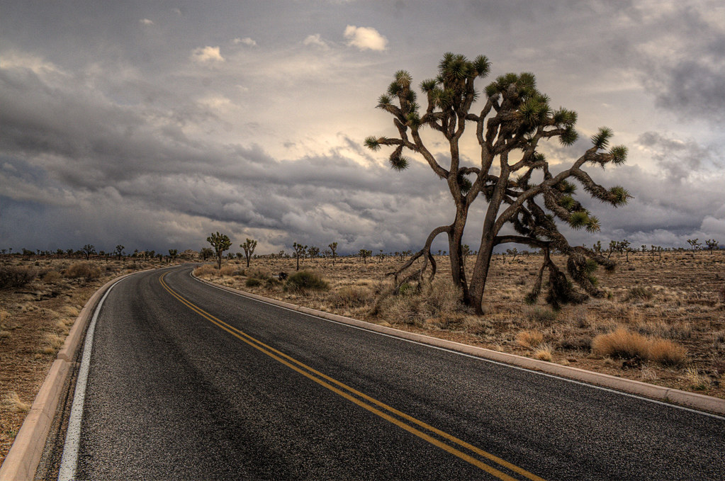
Route 66 Day 17: Joshua Tree National Park
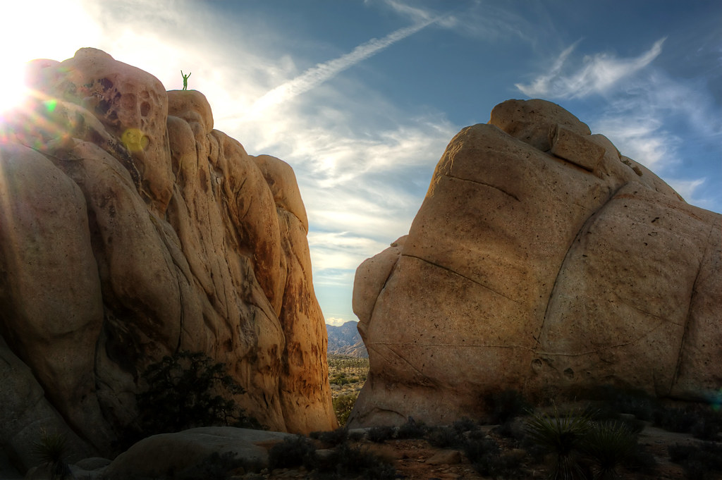
 She beat me to the bottom and by the time I got down I forgot she said that. I waited by the car for a little while then walked around to look for her. I had no idea where she went and wondered if she took a wrong turn coming down. But then I heard a familiar whistle coming from the top of this giant rock. A whistle we used on the AT if we couldn't find each other. I whistled back, she whistled again, so I could hone in on where she was. I looked up and saw this. She's a woman of her word.


A Backpacker's Life List by Ryan Grayson is licensed under a
Creative Commons Attribution-NonCommercial-NoDerivs 3.0 Unported License.
Route 66 Days 15 and 16: Slab City
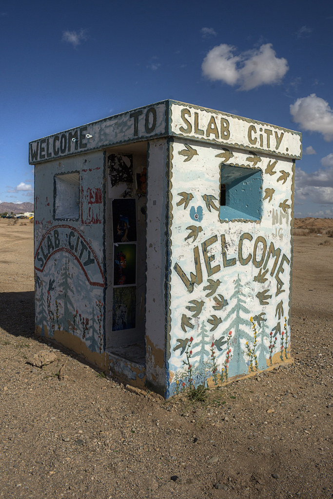 We drove all evening to get to Slab City in Southern California. Slab City isn't on any maps. It's not actually a city either. It's a WWII Marine barracks that was abandoned and bulldozed by the government leaving a grid of concrete slabs. Today it's a free place to stay for any RVer, drifter, or refugee from society that doesn't mind living under a hot sun in the Colorado Desert.
 All I knew is it was 3.5 miles from Niland, California. We knew this because Liv just read the copy of 'Into the Wild' in my car, the book about Chris McCandless, who spent some time in Slab City. While on the AT, Liv and I talked briefly about someday coming here to "live on the cheap under the sun", so this was a necessary stop for us.
With Liv asleep in the passenger seat, I sat in the car on the side of the road looking over our map and flipping through the 'Into the Wild' book to find more clues to where this place might be. A border patrol officer pulled over to see if we needed help. The idea of land that anyone is allowed to live on for free seems so unimaginable in the US, that when I told the cop I was looking for Slab City, I half expected him to say, "Get out of our town hippies... and get a job!". He gave us directions instead.
When the sun came up we pulled out of our spot to visit Salvation Mountain and take a drive to the Salton Sea, but apparently the most solid place to park a car in the desert is not on a series of tunnels left by some burrowing desert mammal. Our tires sank into the loose dirt and sand. We piled flat rocks under the tires to give us traction, but the more we tried to get out the more we sank until the bottom of the car was nearly resting on the ground.


A Backpacker's Life List by Ryan Grayson is licensed under a
Creative Commons Attribution-NonCommercial-NoDerivs 3.0 Unported License.
Route 66 Day 14: Arizona's Scenic Byway
On day 14, we drove toward California along the Arizona section of the National Scenic Byway, also part of Route 66. This section makes me wonder if the Interstates were such a great idea.
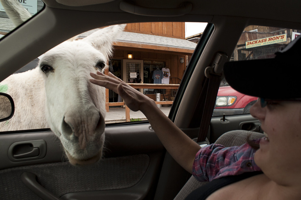 We passed through the small town of Oatman and were surprised to see wild burros roaming freely downtown. Every store sells carrots or burro-chow, but we disappointed the one that stuck his face in a food-less car. Oatman is called the ghost town that wouldn't die, and I can't think of a better way to describe it. It had a sort of boom in population after two gold prospectors struck it rich there in 1915. After that, they kept the town afloat by catering to Route 66 travelers. The scenic road into town seems to be the only thing keeping it going today. This was one of the best stretches of road on Route 66, so far.
This was our last day in Arizona. That afternoon we crossed into the Mojave Desert and Southern California.


A Backpacker's Life List by Ryan Grayson is licensed under a
Creative Commons Attribution-NonCommercial-NoDerivs 3.0 Unported License.
Route 66 Day 13: Grand Canyon
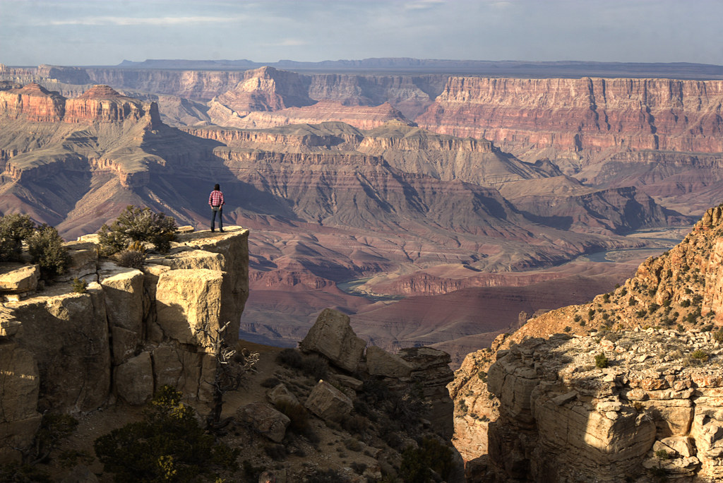
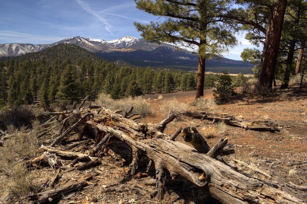 Our day started with a hike to Sunset Volcanic Crater and a visit to the ruins at Wupatki National Monument. Our visit to the Grand Canyon was cut short by an approaching blizzard. At the gate, we were told one to two feet of snow was on the way. We decided to get to lower elevation and warmer weather in Southern California.


A Backpacker's Life List by Ryan Grayson is licensed under a
Creative Commons Attribution-NonCommercial-NoDerivs 3.0 Unported License.
Route 66 Day 12: Petrified Forest

On day 12 we went to the Painted Desert and the Petrified Forest National Park, in Northeastern Arizona. Like every park we visited, the Petrified Forest ended up being better than we imagined. The best feature was the lack of crowds.
After viewing the Painted Desert from the rim and looking at numerous petroglyphs, we hiked alone from the top of Blue Mesa on a winding trail while looking for pieces of petrified wood scattered near the trail. This ended up being one of our favorite national park stops.
After viewing the Painted Desert from the rim and looking at numerous petroglyphs, we hiked alone from the top of Blue Mesa on a winding trail while looking for pieces of petrified wood scattered near the trail. This ended up being one of our favorite national park stops.


A Backpacker's Life List by Ryan Grayson is licensed under a
Creative Commons Attribution-NonCommercial-NoDerivs 3.0 Unported License.
Route 66 Day 11: The Very Large Array
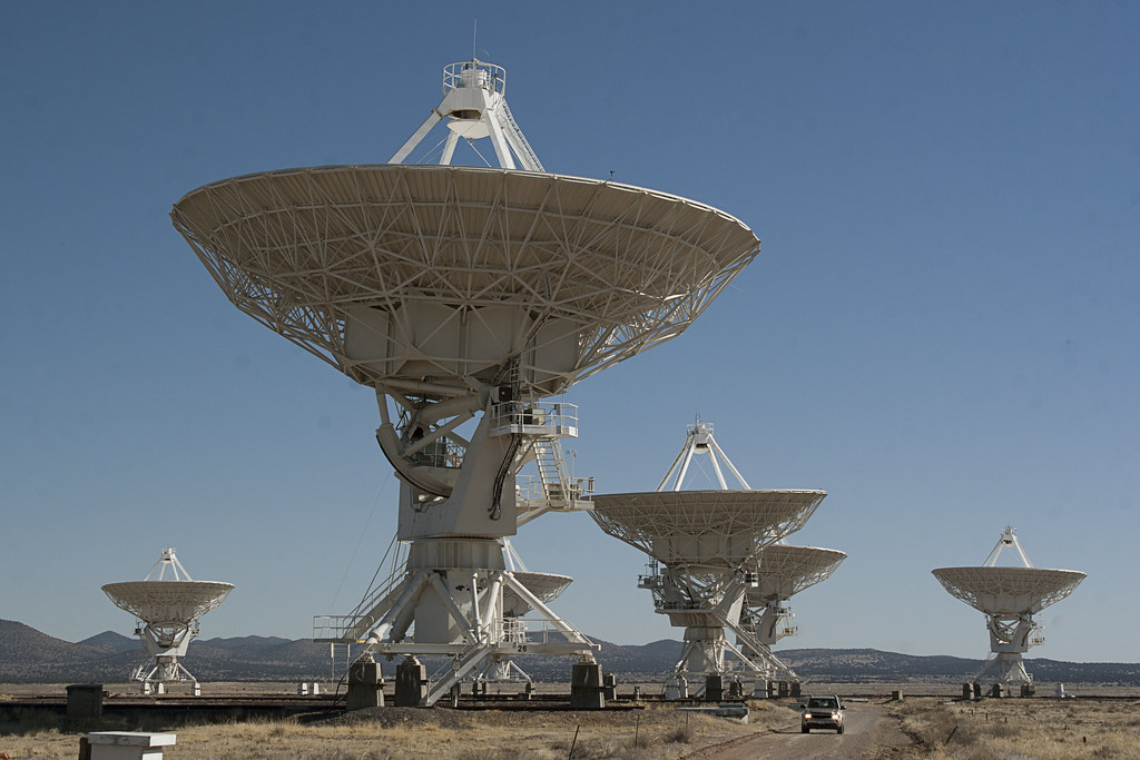
On day 11 we drove west of Socorro, New Mexico to see the Very Large Array radio astronomy observatory. If you know either of us, you know this was my choice and not Liv's.
Numerous discoveries about the universe have been made using these telescopes. Also the movie Contact was filmed here, one of my favorite movies. I'm a nerd. If you were unsure before, now you know. The truck pictured was coming toward us as we were trespassing to get better photos. The guy just nodded at me as he passed. I nodded back. I think there was a kind of nerdly understanding between us.
Numerous discoveries about the universe have been made using these telescopes. Also the movie Contact was filmed here, one of my favorite movies. I'm a nerd. If you were unsure before, now you know. The truck pictured was coming toward us as we were trespassing to get better photos. The guy just nodded at me as he passed. I nodded back. I think there was a kind of nerdly understanding between us.


A Backpacker's Life List by Ryan Grayson is licensed under a
Creative Commons Attribution-NonCommercial-NoDerivs 3.0 Unported License.
Route 66 Day 10: White Sands
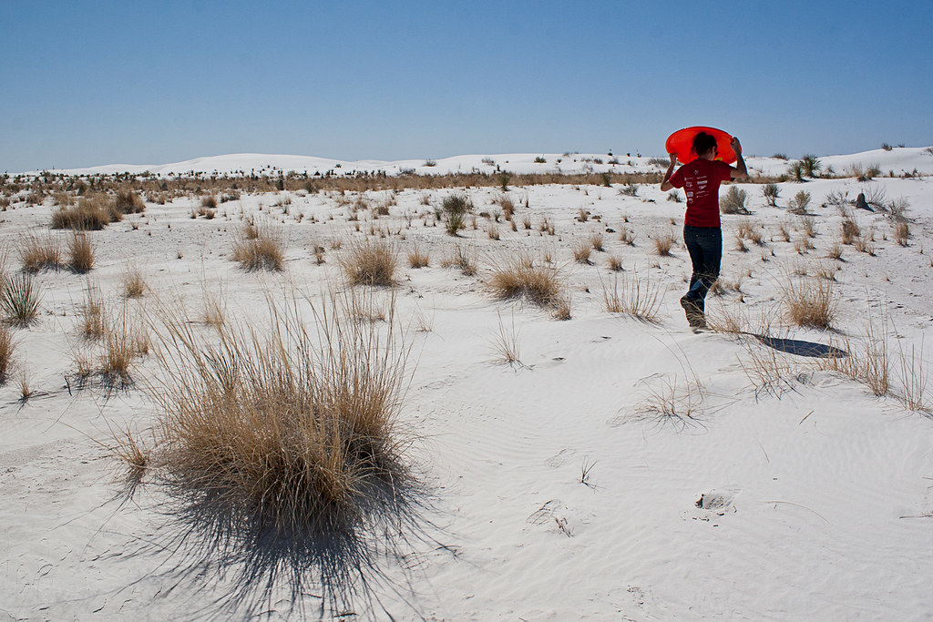
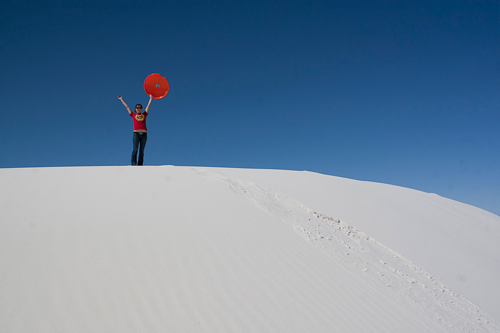 We bought a sled and hiked to the tallest and steepest dune we could find. Occasionally, we heard explosions not too far off in the distance. Apparently, the White Sands Missile Range is still active. After an afternoon of sledding, laying in the sun, and tossing the football around, we got back on the road and headed north to rejoin Route 66.


A Backpacker's Life List by Ryan Grayson is licensed under a
Creative Commons Attribution-NonCommercial-NoDerivs 3.0 Unported License.
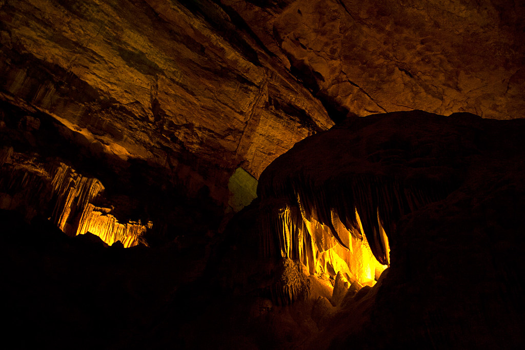
Route 66 Day 9: Carlsbad Caverns
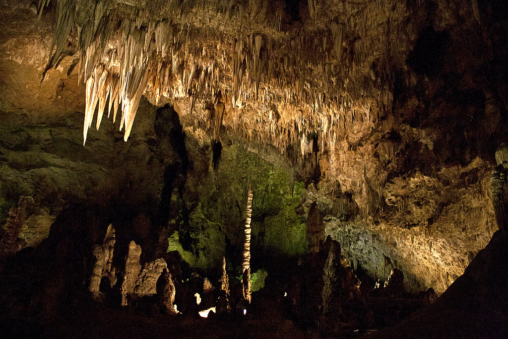
As we descended into the cavern, Liv and I debated whether or not this would be a good place to wait out the eventual Zombie Apocalypse. I was obviously on the pro side, but Liv won the debate by pointing out that if we were being chased by zombies the last place she would want to go is some scary-ass dark hole in the ground. I had no counter-argument.


A Backpacker's Life List by Ryan Grayson is licensed under a
Creative Commons Attribution-NonCommercial-NoDerivs 3.0 Unported License.
Route 66 Day 8: Desert Road


Route 66 Day 8: Roswell

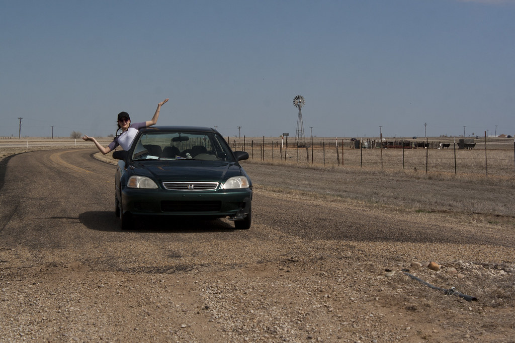
Route 66 Day 7: Cadillac Ranch


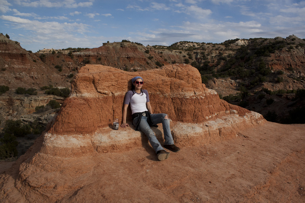
Route 66 Day Six: Palo Duro Canyon
 |
| Liv climbing to the top of Coppertone |
It was an beautiful hike and the weather was perfect. We climbed from the canyon floor to the base of Lighthouse Peak, and then to the top of Coppertone. This is what we were waiting for, getting west and out of the car to hike in some amazing places.
Click on the photos below to enlarge them.
Click on the photos below to enlarge them.


A Backpacker's Life List by Ryan Grayson is licensed under a
Creative Commons Attribution-NonCommercial-NoDerivs 3.0 Unported License.
Route 66 Day Six: The Old Highway
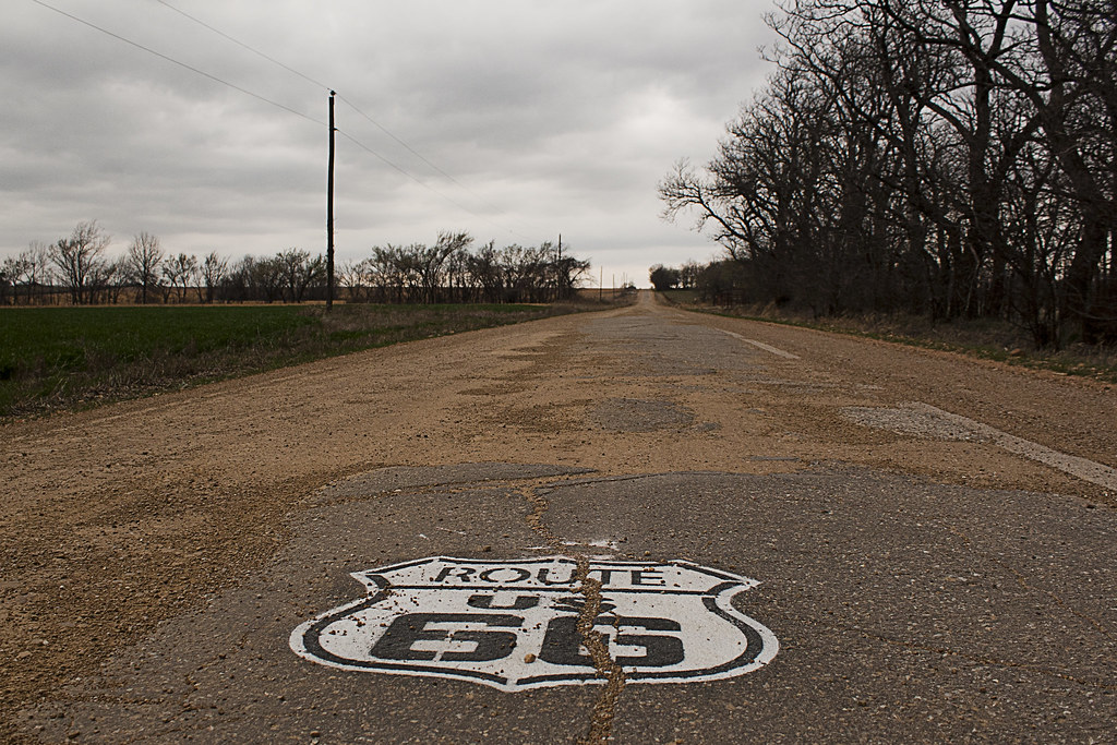
The car was quiet other than the hum of the rough pavement under the tires. Thumper was reading a book. I was daydreaming while looking out at the line of traffic on Interstate 40. So many cars, yet I was the only one on Route 66 as far as I could see. With all the advantages of an Interstate, I tried to think of why I prefer the old road. Why, after hundreds of miles, have I almost developed an emotional attachment to it? I tried to come up with a comparison to explain the difference and thought of old weather-beaten barns. New barns have their advantages too, but they never make me want to pull my car off to the side of the road, grab my camera, and walk across a muddy field to take pictures of it.

Suddenly, I noticed the road change up ahead. I was speeding along at sixty miles per hour then slammed on my breaks. My tires skidded a few yards on the chipped and crumbling highway. Thumper dropped her book to her lap and drew back into her seat. The road’s pavement came to an abrupt end and turned to gravel, grass, and bumpy tire tracks sunken into the soil from previous Sixty-sixers sliding to a stop and U-turning. We laughed at the situation while adrenaline increased our heart rate and turned our legs to jelly. We tried to see if we could continue in the Honda, but they weren’t exactly built for off-road.
A Backpacker's Life List by Ryan Grayson is licensed under a
Creative Commons Attribution-NonCommercial-NoDerivs 3.0 Unported License.
Route 66 Day Five: The Blue Whale
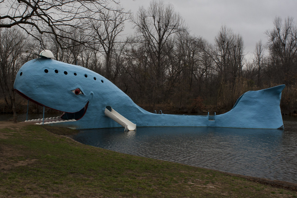
The eighty foot Blue Whale in Catoosa, Oklahoma is easily one of the most recognizable attractions on old Route 66. You can't miss it from the road. We arrived late, after it was closed to the public, so if we were going to spend the night inside of it, we had to be stealthy. And of course, we had to spend the night in it.

The Blue Whale was built in the early seventies to draw visitors to the swimming hole. It closed in 1988.
The highway is only a few dozen yards from the whale and the property owner was in an RV close by with his light still on. We went to a couple bars in town and had a few drinks and played lots of pool. At 2 AM, we went back. We parked at a 24-hour grocery store a few blocks away then grabbed our sleeping bags. The light was still on in the RV, so we had to sneak quietly passed the Closed signs, and into the mouth of the whale.


A Backpacker's Life List by Ryan Grayson is licensed under a
Creative Commons Attribution-NonCommercial-NoDerivs 3.0 Unported License.