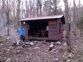
I've hiked roughly 2,700 miles since I bought my first backpack about five years ago. I feel like I can safely call myself an experienced backpacker. But like anything, no matter how much knowledge you accumulate there is more to learn and others that know more than you, so I'm always interested in hearing about new ideas and experiences. That being said, I still love the bad advice I get from non-experienced backpackers.
Last December I was sitting in a fast food chain stuffing my face with disgustingly delicious food when an odd looking woman stopped at my table.
"You hiking the Appalachian Trail?" she asked. I looked at the make-up covered wrinkles on her face and thin penciled-in lines where her eyebrows used to be. I smiled and said, "Yup."
"Isn't it cold up there this time of year?" she said.
"Yeah, it's cold," I said. "But not intolerable yet."
"You know what you can do to stay warm?" she said. I hoped for new ideas. Truth is, I was freezing my ass off up there. "Get one of them really big trash bags. They make them really big ones that come all the way up to here," she said while miming pulling the trash bag up to her chest.
"My husband and I go to DisneyWorld for three days every year," she said. "We sleep in our van in the parking lot. One night I got real cold, so he told me to get into the trash bag. It kept me warm all night."
"Alright. I'll keep that in mind," I said, preventing myself from pointing out that December in the Smoky Mountains is a bit colder than Orlando any time of year, not to mention the resulting condensation could be very dangerous.
Sometimes the advice isn't as bad, but still quite useless, like when Red and I were stopped on a sidewalk in a town by a man wearing a sweatsuit.
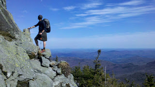
"You guys hiking the Long Trail?" he asked.
"Yeah," we said together.
"Watch out for Bigfoot," he said sincerely while running his fingers through his messy oily hair. "He's been spotted up there."
"Alright, alright," Red said. "We'll keep that in mind."
"Man, I'd love to catch that Bigfoot myself. You know how rich you'd be if you caught him?" he said. "And famous?"
"Oh man, yeah," Red said politely. "We'll keep our eyes out for him."
A couple days later, we were in another fast food chain. An elderly man wearing glasses with lenses like magnifying glasses stopped at our table on his way to the restroom.
"You guys hiking the Long Trail?" he asked. It was late in the day and we told him we were about to head back up there that night.
"You hike up there at night?" he asked concerned. His eyes grew even larger behind the magnifying lenses. He had a slacked worried look on his face. His mouth hung open. His cheeks drooped from his face like a basset hound's.
"You gotta be careful with all that wildlife up there at night. The forests are filled with dangerous nocturnal animals," he said. "...like otters."
"Otters, really?" we said.
"Yeah, they'll come at you," he said. "They bite."
I've been warned numerous times about bears coming into my camp. I've been told to watch out for wild boars charging down the trails. Nobody has ever warned me about the predatory nature of nocturnal river otters.
Occasionally I do get good advice and I love that, but honestly, I'm enjoying the bad advice much more. Keep it coming America.
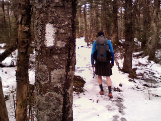
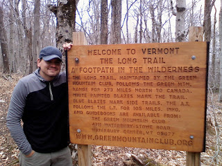
 Red and I are now headed to the southern terminus of Vermont's Long Trail. It is a 273-mile trail that spans from the borders of Massachusetts and Canada. This will also cover the section of the AT in Vermont that was closed during Hurricane Irene. I'll post our progress and stories along the way.
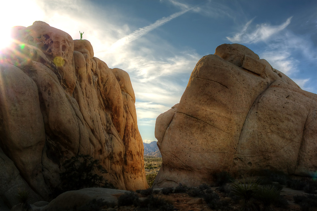
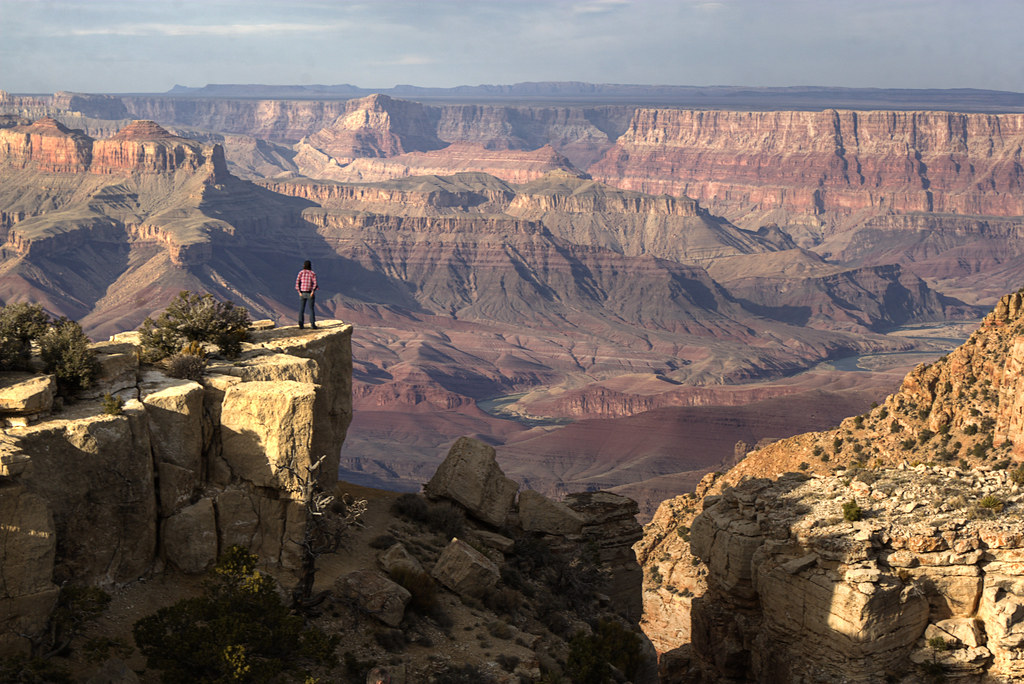
 She beat me to the bottom and by the time I got down I forgot she said that. I waited by the car for a little while then walked around to look for her. I had no idea where she went and wondered if she took a wrong turn coming down. But then I heard a familiar whistle coming from the top of this giant rock. A whistle we used on the AT if we couldn't find each other. I whistled back, she whistled again, so I could hone in on where she was. I looked up and saw this. She's a woman of her word.


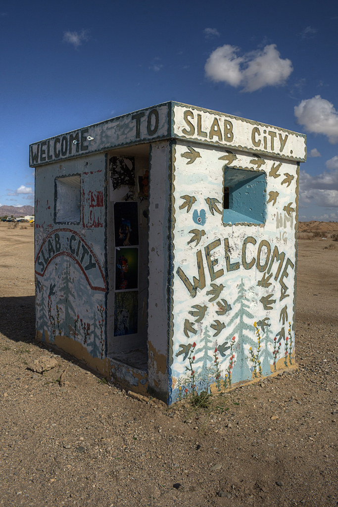 We drove all evening to get to Slab City in Southern California. Slab City isn't on any maps. It's not actually a city either. It's a WWII Marine barracks that was abandoned and bulldozed by the government leaving a grid of concrete slabs. Today it's a free place to stay for any RVer, drifter, or refugee from society that doesn't mind living under a hot sun in the Colorado Desert.
 All I knew is it was 3.5 miles from Niland, California. We knew this because Liv just read the copy of 'Into the Wild' in my car, the book about Chris McCandless, who spent some time in Slab City. While on the AT, Liv and I talked briefly about someday coming here to "live on the cheap under the sun", so this was a necessary stop for us.


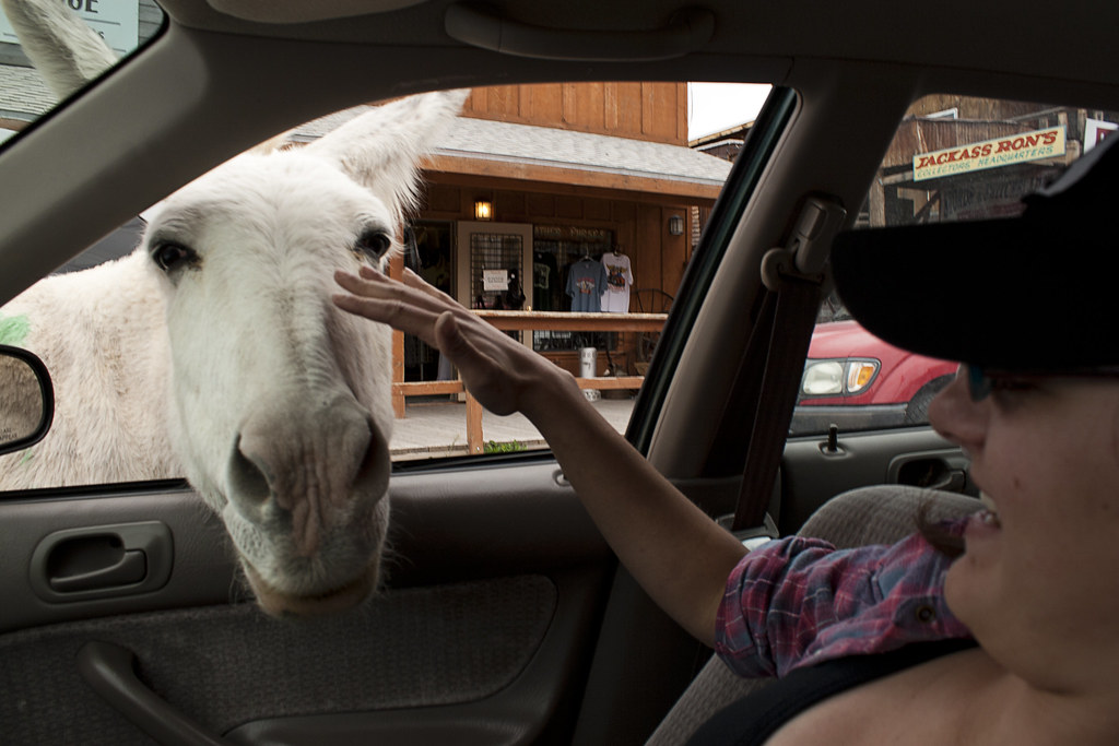 We passed through the small town of Oatman and were surprised to see wild burros roaming freely downtown. Every store sells carrots or burro-chow, but we disappointed the one that stuck his face in a food-less car. Oatman is called the ghost town that wouldn't die, and I can't think of a better way to describe it. It had a sort of boom in population after two gold prospectors struck it rich there in 1915. After that, they kept the town afloat by catering to Route 66 travelers. The scenic road into town seems to be the only thing keeping it going today. This was one of the best stretches of road on Route 66, so far.


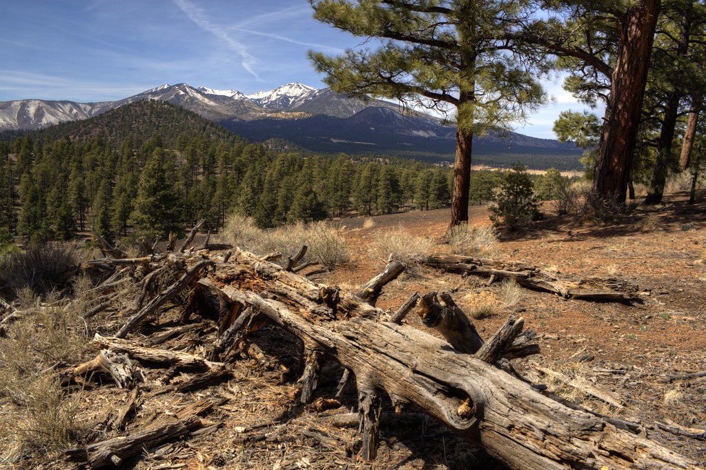 Our day started with a hike to Sunset Volcanic Crater and a visit to the ruins at Wupatki National Monument. Our visit to the Grand Canyon was cut short by an approaching blizzard. At the gate, we were told one to two feet of snow was on the way. We decided to get to lower elevation and warmer weather in Southern California.


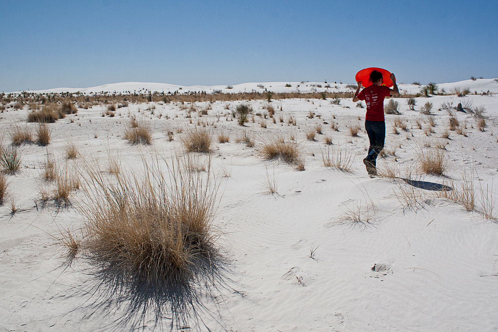
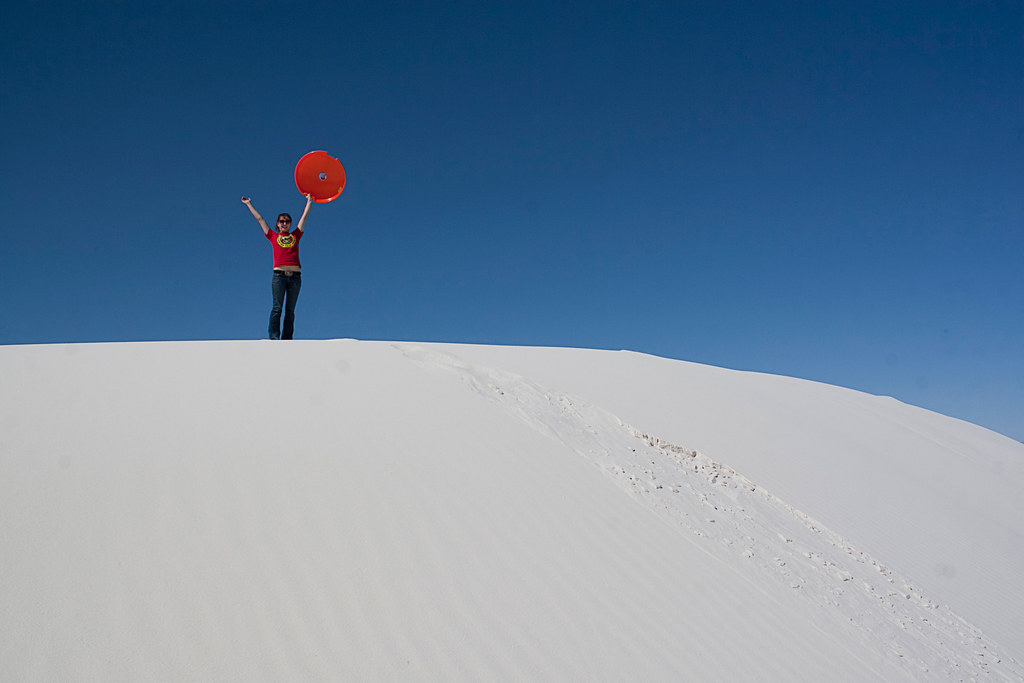 We bought a sled and hiked to the tallest and steepest dune we could find. Occasionally, we heard explosions not too far off in the distance. Apparently, the White Sands Missile Range is still active. After an afternoon of sledding, laying in the sun, and tossing the football around, we got back on the road and headed north to rejoin Route 66.